Subject: East Bay, California
Period: 1879 (circa)
Publication:
Color: Printed Color
Size:
16.9 x 13.1 inches
42.9 x 33.3 cm
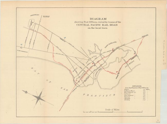
This basic map depicts the eastern San Francisco Bay and locates Berkeley, Oakland, and Alameda. The route of the Central Pacific Railroad and its branch lines are depicted in red overprinting, and post offices are represented by tiny flags. Those post offices that are visited by the trains are shown with American flags, while those not on the train lines are represented by blue flags. A table at lower right shows distances from various points to the San Francisco Post Office. Also of interest is the "State University Grounds" (UC-Berkeley).
With the completion of the transcontinental railroad in 1869, mail heading to the west coast was delivered predominantly by railroad (previously by the Overland Route or via the Isthmus of Panama). Having post offices located directly on these lines simplified the process of delivering mail and further decreased time in transit. On this map, 5 of the 7 post offices in the East Bay lie directly on this line.
References:
Condition: B+
Issued folding with a hint of toning and minor foxing.