Subject: Atlases
Period: 1857 (published)
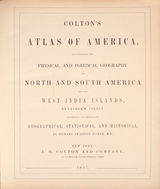
Publication:
Color: Hand Color
Size:
15.8 x 18.4 inches
40.1 x 46.7 cm
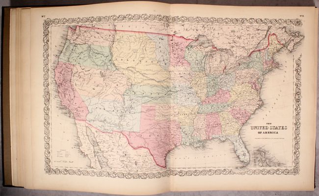
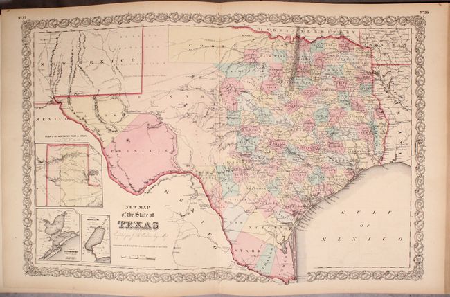
This attractive folio atlas contains 61 of the 63 map sheets called for (missing only the double-page map of New York City). The atlas is similar to Volume I of Colton's Atlas of the World but is more robust (63 sheets versus 44). Included are double-page maps of the United States and Texas, and several maps of the western United States show early and unusual territorial configurations.
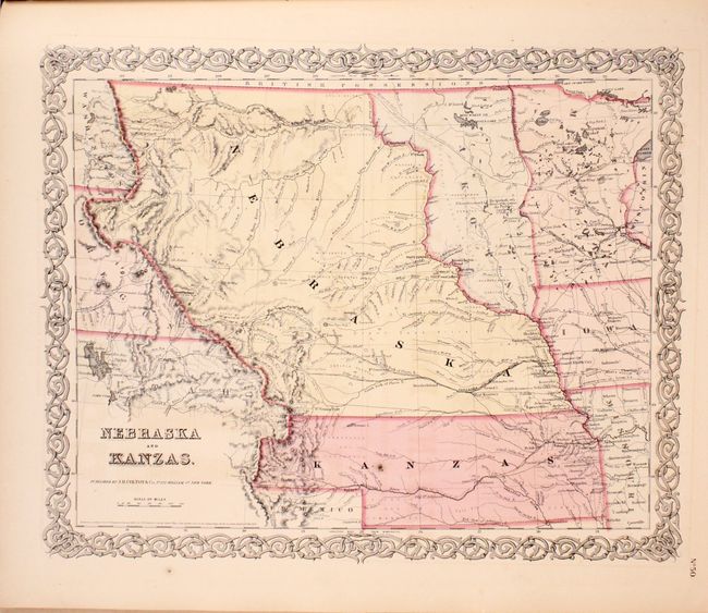
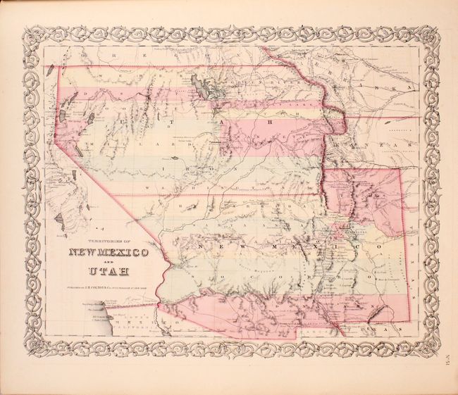
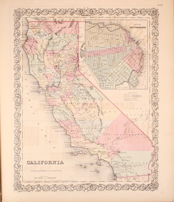
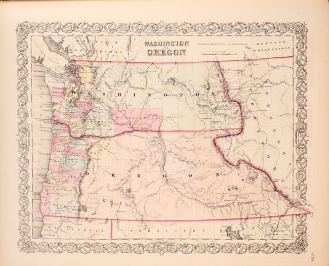
The U.S. map features Kanzas and shows Dakotah territory bordering the Missouri River. The atlas also includes the most desirable Nebraska and Kanzas map that depicts Nebraska stretching from Kansas to the Canadian border and bounded on the west by Washington and Oregon at the Continental Divide and Dakota on the east. Includes the map of the territories of New Mexico and Utah, the California map with the large inset of San Francisco, and the territories of Washington and Oregon with their eastern boundaries on the Continental Divide and county development limited to the coastal areas. The map of Texas is "Compiled from De Cordova's Large Map" with early county configurations and the large unsettled areas of Presidio, El Paso, Bexar in the west. U.S. city plans include Boston, Philadelphia, Baltimore, Washington, Savannah/ Charleston, Louisville/New Orleans, Pittsburgh/Cincinnati, and St. Louis/Chicago.
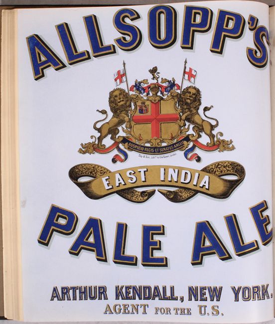
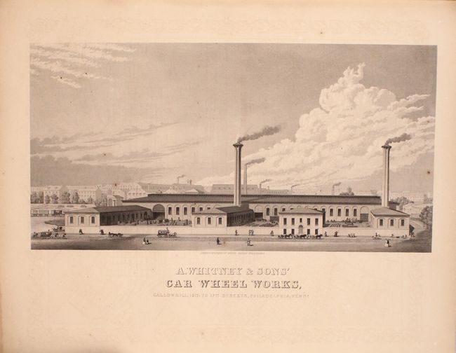
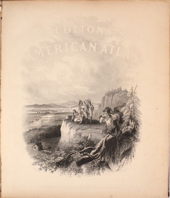
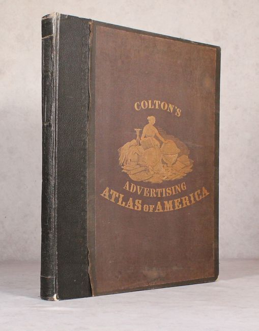
The maps are complimented by additional illustrations including an attractive frontispiece showing Native American Indians overlooking a valley filled with frontier settlement and development. Interspersed within the text and maps are numerous full-page advertisements including a very unusual full-color ad for "Allsopp's East India Pale Ale" adjacent to the map of New Jersey. Hardbound in later brown cloth with the original gilt illustration pasted on top of the front cover.
References:
Condition: B+
The maps range from good to near fine with overall pleasant light toning and offsetting on some maps from advertisements on opposing pages. This offsetting is more prominent on the maps of eastern Canada, Missouri, Baltimore and Washington D.C. The contents contain no tears or separations. The later binding is lightly worn with minor cloth separations from the boards in a few places and a small area of cloth is missing from the rear board. The binding is still intact with bumped edges and somewhat loose hinges.