Subject: Cartographic Miscellany, Europe, World War II
Period: 1940 (dated)
Publication: Fortune Magazine
Color: Printed Color
Size:
43.6 x 28 inches
110.7 x 71.1 cm
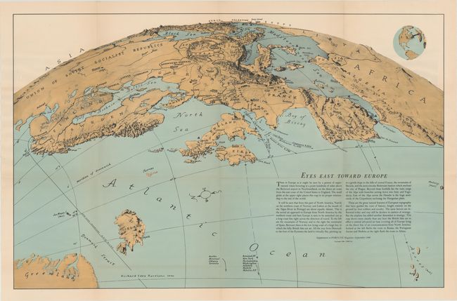
This striking "Air Age" map was drawn by Richard Edes Harrison and depicts the continent of Europe as if "hovering at a point hundreds of miles above the Botswood airport in Newfoundland." This unusual orthographic projection was employed because it simulates the perspective of the northern air route from North America to Europe. The explanatory text describes how the map demonstrates that the northern coast of Norway is equidistant to Lisbon, Portugal and that the British Isles are strategically located as a central airbase to access mainland Europe. Published as a supplement to the September 1940 issue of Fortune Magazine - a little more than a year before the United States would join the Allied forces.
References: cf. Hornsby (Picturing America) pp. 225-226.
Condition: A
Issued folding with a few short splits at fold intersections.