Subject: Puducherry, India
Period: 1760 (circa)
Publication: Schauplatz des Gegenwaertigen Kriegs
Color: Hand Color
Size:
14 x 8.3 inches
35.6 x 21.1 cm
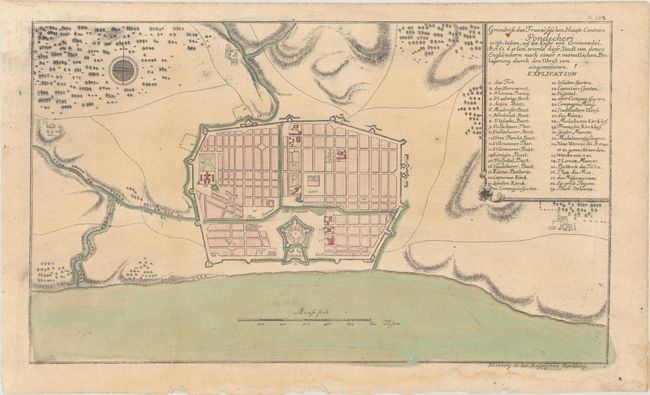
This uncommon plan of Puducherry (or Pondicherry) was published in Raspe's Schauplatz des Gegenwaertigen Kriegs, which contained over 150 maps and battle plans relating to the worldwide theater of the Seven Years' War. In September 1760, the British besieged Puducherry, then a French colonial outpost. After the city was brought to the brink of starvation, French commander Thomas Arthur, comte de Lally surrendered on January 15, 1761. The French would regain the city in 1763 with the signing of the Treaty of Paris. Raspe's plan details the fortifications, with a key in the title cartouche identifying 39 areas of interest.
References: Phillips (Atlases) #2825; Shirley (BL Atlases) G.RASP-1a #138.
Condition: B+
On watermarked paper with light toning, a printer's crease at right, and a couple short edge tears at bottom that have been repaired and reinforced with old paper on verso. There is a dampstain confined to the bottom blank margin.