Catalog Archive
Auction 173, Lot 378
"An Accurate Map of the Holy Land Divided into the XII Tribes of Israel. Accomodated to Sacred History, & Describing the Travels of Jesus Christ", Bowen, Emanuel
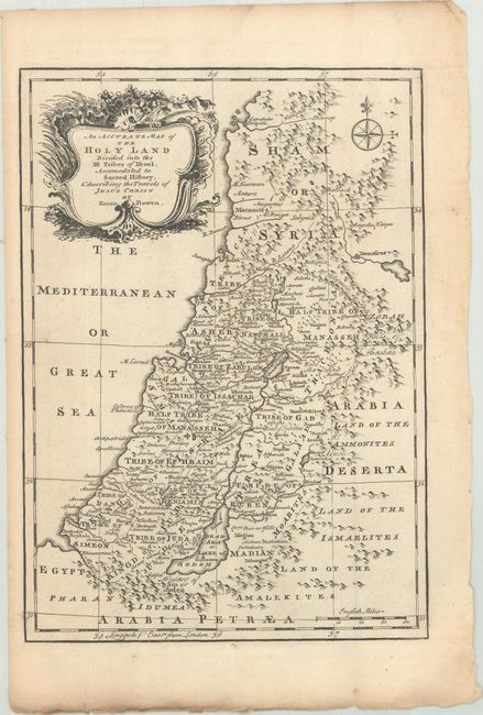
Subject: Holy Land
Period: 1766 (published)
Publication: The Maps and Charts to the Modern Part of the Universal History
Color: Black & White
Size:
9 x 12.6 inches
22.9 x 32 cm
Download High Resolution Image
(or just click on image to launch the Zoom viewer)
(or just click on image to launch the Zoom viewer)