Subject: Holy Land
Period: 1536 (circa)
Publication: Mer des Hystoires
Color: Black & White
Size:
8.6 x 12.2 inches
21.8 x 31 cm
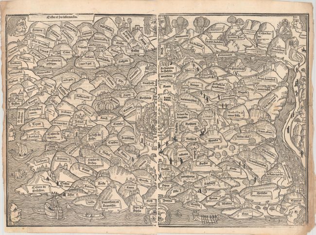
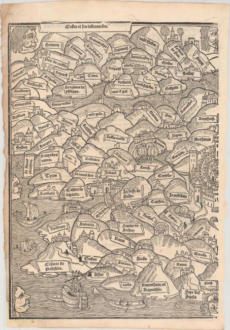
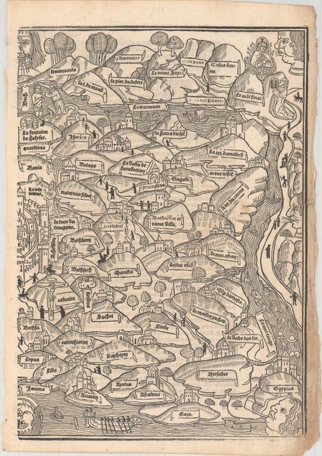
This map of the Holy Land is from the rare and popular Mer des Histoires, a French translation of the world history, Rudimentum Novitiorum. First published in 1475, the Rudimentum Novitiorum was the first publication to include printed maps depicting land forms and countries (one of the world and one of Palestine). The French edition served to popularize the work, and first appeared as Mer des Hystoires in 1488 with new woodblocks, on a slightly smaller scale and with the titles translated into French. A third set of woodblocks were cut in 1491, again slightly reduced in size, and with a few minor changes. In his book, The Earliest Printed Maps, Tony Campbell remarks that the maker of the maps for the 1491 edition was a "thinking individual," because he corrects errors made in 1475 and 1488 blocks. The 1491 blocks were reused in several editions through circa 1550.
This map of Palestine is centered on Jerusalem and is oriented with east at the top. This was the first printed map based on first-hand observation, depicting Palestine based on a 13th century pilgrimage. The map extends from Sidon and Damascus in the north to the Red Sea in the south. Eight windheads surround the map. Printed on two sheets, as issued, with French text on verso.
References: Laor #221.
Condition: B+
An excellent impression on bright sheets with light soiling along the right and left-hand edges and a couple of small spots of soiling in the image. There is a 1/2" tear at right that has been archivally repaired, and a 1" chip at bottom left (encompassing the next and jaw of the windhead) that has been professionally replaced with the image seamlessly replaced in facsimile. The first image is a composite image - the map is in two separate sheets.