Catalog Archive
Auction 173, Lot 275

Stunning Oversized Plan of Paris

"Le Plan de Paris, Ses Faubourgs et Ses Environs / Platte Grond van Parys, zyn Voorburgen en Omleggende Plaatse", Delisle/Covens & Mortier

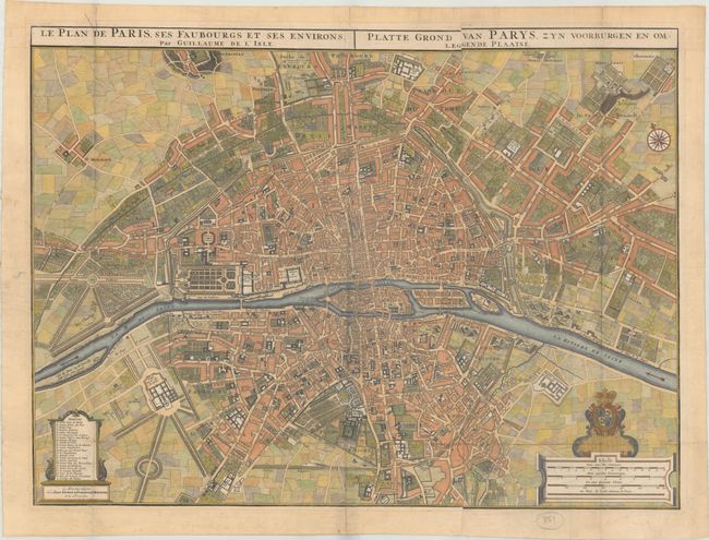
Subject: Paris, France

Period: 1730 (circa)

Publication:

Color: Hand Color

Size:
29.3 x 21.9 inches
74.4 x 55.6 cm
Download High Resolution Image
(or just click on image to launch the Zoom viewer)

This large-scale plan of Paris also depicts its surrounding faubourgs and environs, and is based on the work of Nicolas de Fer. A lettered key names and locates 23 important buildings. Streets, churches, palaces, gardens, boat yards, orchards, hotels, and much more are depicted on this superb plan. Major sites such as the Louvre Castle, Notre Dame, Place de Vosges, and Luxembourg Gardens are identified. This fully engraved and handsome chart is further embellished with a large city coat of arms, a very nice compass rose, and four distance scales. Title above map is in both French and Dutch. Printed on two sheets, joined.

References:

Condition: B+

A nice impression, issued folding, with a few short fold separations and marginal toning. An edge tear at top is confined to the blank margin.

Estimate: $2,400 - $3,000

Sold for: $1,800

Closed on 6/5/2019

Archived