Subject: France
Period: 1953 (dated)
Publication:
Color: Printed Color
Size:
42.9 x 38 inches
109 x 96.5 cm
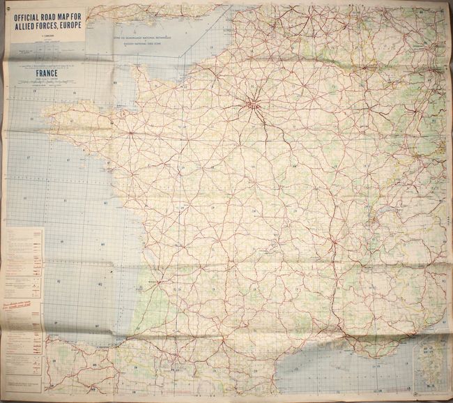
This large and detailed map was part of a series of maps delineating roadways for the Allied forces in post-war Europe. The focus here is France, with both English and French keys at bottom left identifying main roads, super highways, other paved roads, destroyed bridges, customs posts, air and sea connections, and more. The width, straightness, and steepness of roads are indicated as well. The map is divided into U.T.M. grid zones. It extends to include parts of neighboring countries, showing major cities such as Brighton, Brussels, Cologne, Frankfurt, Turin, and Zurich. An inset at bottom right zooms in on Corsica. "Prepared under the direction of the Engineer, USAREUR by Michelin, Paris - 1953."
References:
Condition: B+
Issued folding with some small holes, minor spots, and marginal toning.