Subject: Gulf of Mexico, Cuba & Bahamas
Period: 1865 (dated)
Publication:
Color: Black & White
Size:
84.2 x 26 inches
213.9 x 66 cm
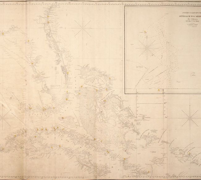
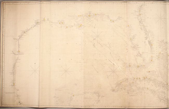
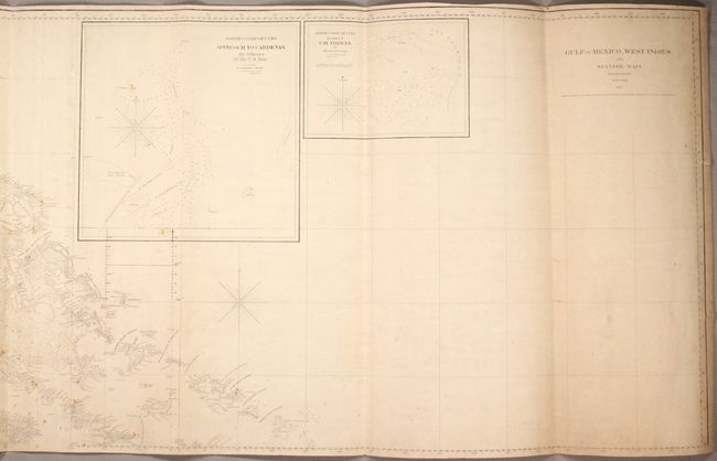
This remarkable, large-scale, blue-backed chart covers the entire Gulf Coast of the United States, extending south to Tuxpan Mexico, and including the Bahamas and most of Cuba. The chart extends upstream of several of the larger rivers with some inland detail, primarily in Florida. Two large insets show the approach to Cardenas and Cay Frances on the northern coast of Cuba. Packed with information useful to the mariner, the chart includes numerous depth soundings, shoals, anchorages, current directions, and ground types. Numerous lighthouses are identified with red and yellow hand color. Printed on three sheets, joined and backed with stiff blue paper, as issued, with the original paper title label on verso.
References:
Condition: B
Light overall toning and soiling with some light creasing. Two of the creases have resulted in 1" tears at far right. There are navigational routes and notations in pencil between the mouth of the Mississippi River, western Cuba, and the Florida Keys. Although likely originally rolled, this example is folding, which makes for easier storage and viewing.