Subject: Southwestern United States & Mexico
Period: 1863 (dated)
Publication: Senate Ex. Doc. No. 1 - Special Session, 1863
Color:
A nice set of Civil War period maps that illustrate the supply routes in New Mexico Territory and vicinity to the Pacific. Each was published under the direction of the Head Quarters in Santa Fe and are signed in the plate "Cyrus H. DeForrest, 1st Lieut. & Aide-de-Camp."
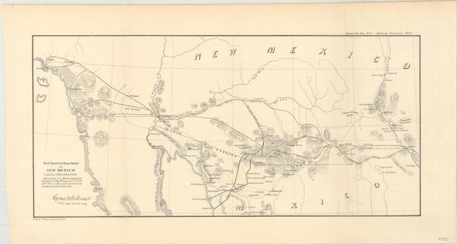
A. Head Quarters Department of New Mexico Santa Fe, N.M., black & white (14.1 x 6.6"). This important map covers the majority of New Mexico Territory and southern California to include Los Angeles and Mexico south to the town of San Francisco. The map notes several "Practicable Rail Road" routes across the region and into Mexico. Also locates silver, gold and copper mines including the Stevensons Silver Mines east of Dona Anna. Several forts are noted including Yuma, Craig, Thorn and Fillmore. Near today's Puerto Penasco is a Shell Observatory, a location we've not previously seen on any map. Major David Fergusson was charged with making a survey of Port Lobos and Libertad on the Gulf of California to determine whether "Arizona and the Mesilla valley" could be supplied from Kansas City or from Texas. His explorations further demonstrated the viability of a railroad route to the Pacific via a southern route. Wheat considered this the only military map of note produced in 1862 and to which he devotes an entire page of description.
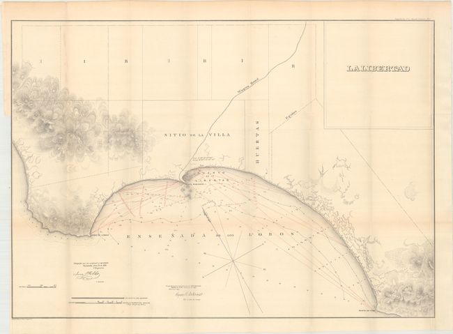
B. La Libertad, printed color (28.8 x 20.3"). This large map details the area around Mexico's Puerto de la Libertad, here called Ensenada de los Lobos, in the state of Sonora. Recently surveyed soundings in the harbor are shown in red overprinting.
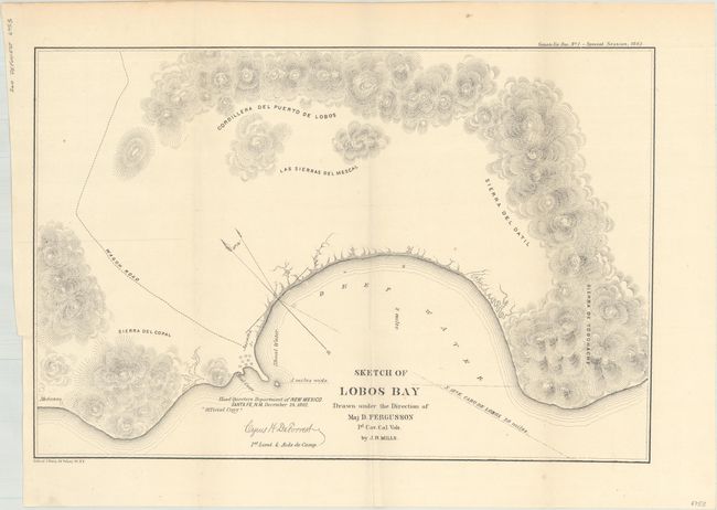
C. Sketch of Lobos Bay, black & white (14.3 x 9.7"). Details Lobos Bay, naming Seal Cove and the village of Jacates.
References: Wheat (TMW) #1042.
Condition: A
Issued folding with a hint of toning.