Subject: Southwestern United States & Mexico
Period: 1702 (dated)
Publication: Der Neue Welt-Bott
Color: Black & White
Size:
9.2 x 13.6 inches
23.4 x 34.5 cm
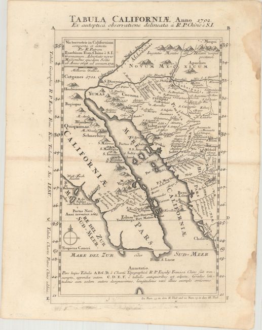
This is Father Kino's second map of Lower California disputing the notion that California was an island. Unlike Kino's smaller map of 1701 that was published numerous times, this map is much rarer - appearing only in this rare German Jesuit magazine in 1726. The map shows the Baja peninsula and locates the earliest California mission at Loreto and numerous missions in Mexico. It accurately depicts the region, in particular the relative positions of the Colorado and Gila rivers and the correct location of the rivers, valleys and mountains of part of Sonora and Arizona.
This scarce map is essential to any collection of California or the American Southwest. Not in Wheat or Wagner.
References: Phillips (Maps) p. 184; Polk, pp. 295-302.
Condition: B+
A sharp impression on watermarked paper with minor toning along the centerfold and several damp stains in the right blank margin, well away from the image.