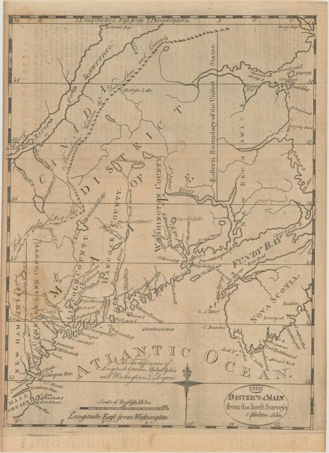
Subject: Maine
Period: 1793 (circa)
Publication: American Universal Geography
Color: Black & White
Size:
8 x 10.6 inches
20.3 x 26.9 cm
This scarce and finely engraved map from the American Universal Geography is considered the first obtainable map that focuses on Maine. The northwest boundary with Canada has the notation "High Lands Being the Boundaries between the United States and Canada." This gives a northern border further north than that which was eventually decided. Only four counties are noted and Moosehead Lake is misspelled Mousehead Lake. Longitude is measured east from Washington and Philadelphia. This early edition varies from later Morse issues with finer engraving, a notation to the left of the compass rose, the title contained in an oval cartouche, and no outer neatline.
References: Wheat & Brun #168.
Condition: B+
Issued folding with minor scattered foxing and light text offsetting at top from an opposing page of text.