Subject: References
Period: 1981-2000 (published)
Publication:
Color:
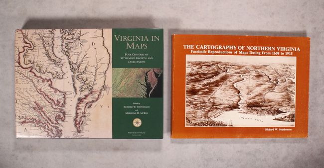
A. Virginia in Maps - Four Centuries of Settlement, Growth, and Development, by Richard W. Stephenson and Marianne M. McKee, published 2000, printed color (15.5 x 11.4"). Published by the Library of Virginia, this comprehensive reference work chronicles the discovery, settlement, growth, and development of Virginia. It includes full color reproductions of 187 important maps. An indispensable reference work for collectors of Virginia maps. 335 pp. Hardbound in green buckram with gilt titling on cover and spine. Full-color printed dust jacket. Condition: Like new; signed by the authors on the title page.
B. The Cartography of Northern Virginia - Facsimile Reproductions of Maps Dating from 1608 to 1915, by Richard W. Stephenson, published 1981, black & white (14.9 x 10.9"). This superb reference, published by the History and Archaeology Section Office of Comprehensive Planning in Fairfax, Virginia, catalogs 122 black and white plates depicting Northern Virginia. Beginning with John Smith's 1608 map of Virginia and culminating with a 1915 U.S.G.S. topographic map of Fairfax County, this reference spans more than 300 years of mapping the region. Selected by Richard W. Stephenson, who also wrote the informative introduction. Paperback with illustrated covers. 145 pp. Condition: Light wear to the covers.
References:
Condition: A
See description.