Catalog Archive
Auction 172, Lot 680
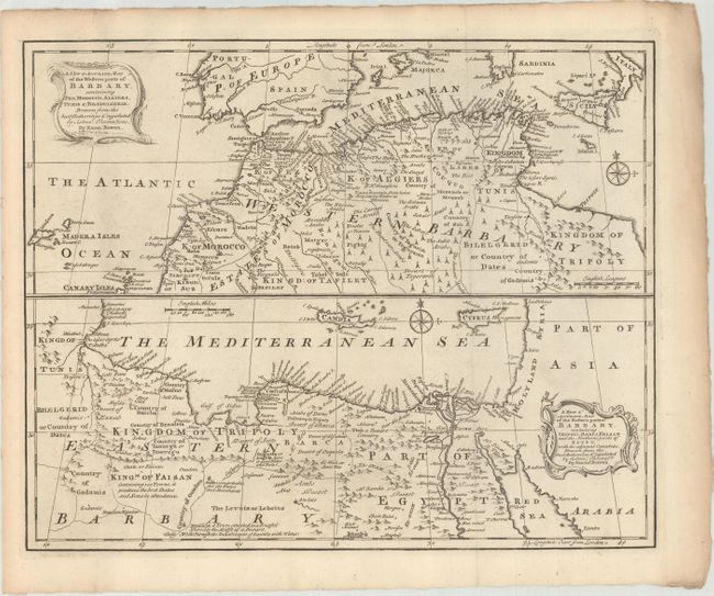
"A New & Accurate Map of the Western Parts of Barbary, Containing Fez, Morocco, Algiers, Tunis & Biledulgerid... [on sheet] A New & Accurate Map of the Eastern Parts of Barbary, Containing Tripoli, Barca, Faisan and the Northern Parts of Egypt...", Bowen, Emanuel
Subject: Northern Africa
Period: 1750 (circa)
Publication:
Color: Black & White
Size:
16.6 x 13.3 inches
42.2 x 33.8 cm
Download High Resolution Image
(or just click on image to launch the Zoom viewer)
(or just click on image to launch the Zoom viewer)