Subject: Holy Land
Period: 1650 (circa)
Publication:
Color: Hand Color
Size:
12.6 x 11.1 inches
32 x 28.2 cm
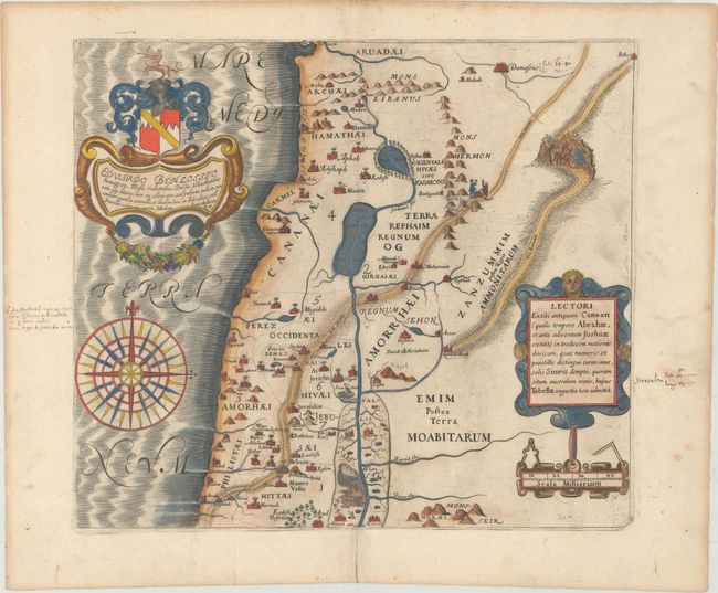
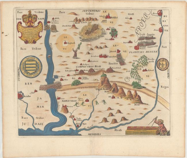
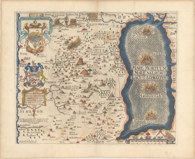
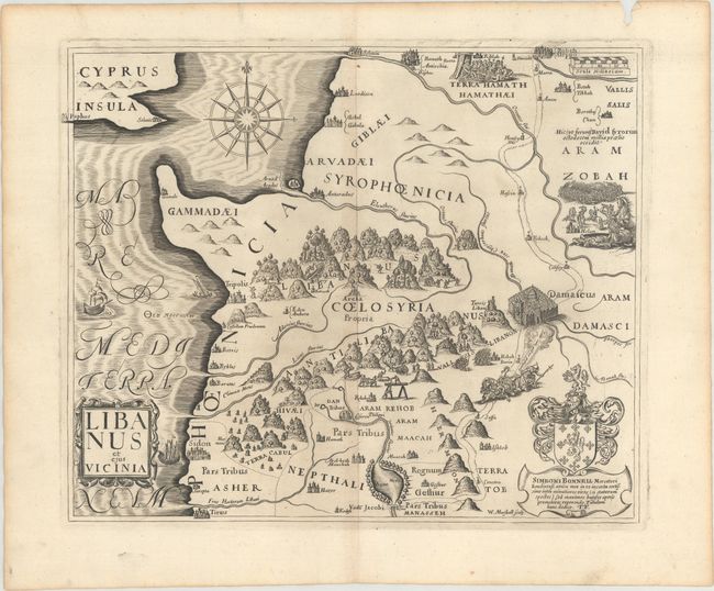
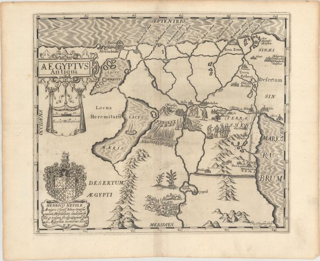
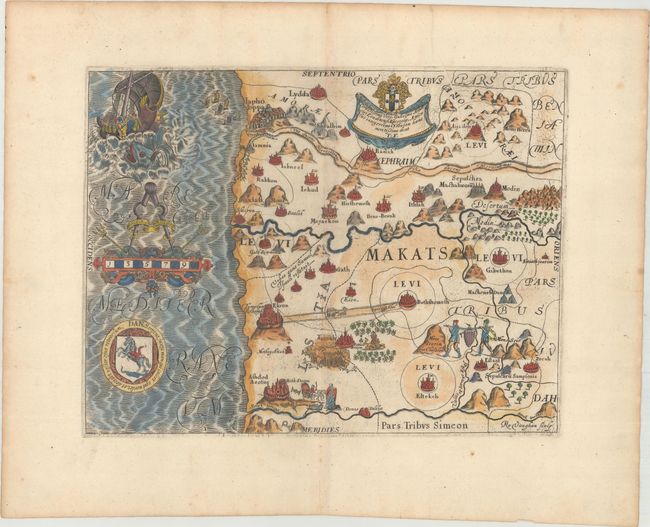
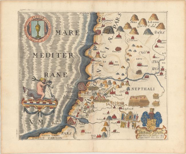
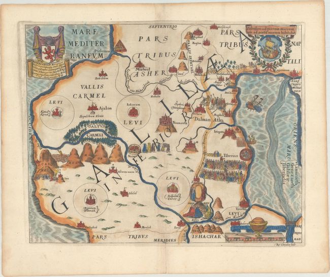
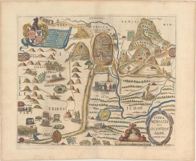
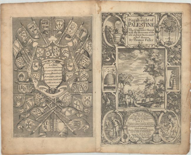
Thomas Fuller (1608-1661) was a respected English clergyman who wrote several books on the history and geography of the Holy Land. His A Pisgah-Sight of Palestine, published in 1650, was a geographical description of the Holy Land with special reference to biblical history. A Pisgah is translated as a mountain ridge, and typically refers to Mount Nebo, which is believed to be the summit from which Moses saw the Promised Land. The maps in the book were derived from the cartography of Adichom supplemented by Fuller's own wide reading. Fuller financed the book by dividing it into sections and finding sponsors for each one. To acknowledge the patrons, all maps contained decorative cartouches with the sponsor's coat of arms and a dedication to him.
This disbound set includes the title page, frontispiece, 19 maps (of 20 - missing the plan of Jerusalem), and four engravings of Solomon's temple, a tabernacle, and biblical scenes. The maps included are: a general map of old Canaan, Reuben, Gad, Manasseh Transjordanicam, Napthali, Assher, Zebulon, Issachar, Manasseh Cisjordanicam, Ephraim, Dan, Simeon, Benjamin, Juda, Terra Moraith, Libanus et eius Vicinia, Confinia Palestinae...ad Orientem, Desertum Paran, Aegyptus Antiqua.
References: Laor #279-295; Nebenzahl (HL) p.128-131, #9; Shirley (BL Atlases) G.FULL-1a.
Condition: A
Seven of the maps are in full hand color, and the remaining twelve maps, the title page, the frontispiece, and the additional engravings are in black and white. There is light toning along the edges of the sheets. Several maps have short fold separations at bottom, most of which have been archivally repaired, with the exception of Napthali and Desertum Paran. The general map of Canaan has a couple of minor manuscript notations in the map and the blank margins. Libanus et eius Vicinia has a small chip also confined to the edge of the sheet. The map of Reuben has a small hole that has been professionally infilled with a minor amount of image replaced in facsimile, and Simeon has a very small hole at left that has not been repaired.