Subject: Mediterranean
Period: 1741 (published)
Publication: Description Exacte de l'Univers, ou l'Ancienne Geographie Sacree et Profane
Color: Hand Color
Size:
20.3 x 15.1 inches
51.6 x 38.4 cm
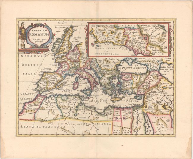
Attractive map showing the extent of the Roman Empire throughout Europe, northern Africa and the Middle East. Large inset map of the vicinity of Rome. Finely decorated with garlands and a strapwork cartouche flanked by a Roman soldier. Philippe Briet is credited in the title cartouche. Blank verso, published in Pieter de Hondt's Description Exacte de l'Univers, ou l'Ancienne Geographie Sacree et Profane, a French edition of Georgius Hornius' Accuratissima Orbis Antiqui Delineatio, which included maps from Johannes Jansson's historical atlas and Abraham Ortelius' Parergon.
References: Van der Krogt (Vol. I) #0830H:1.
Condition: A
A sharp impression on a clean sheet with wide margins and minor toning along the edges of the sheet and small damp stains in the corners, well away from the image.