Subject: Low Countries
Period: 1720-1843 (circa)
Publication:
Color: Hand Color
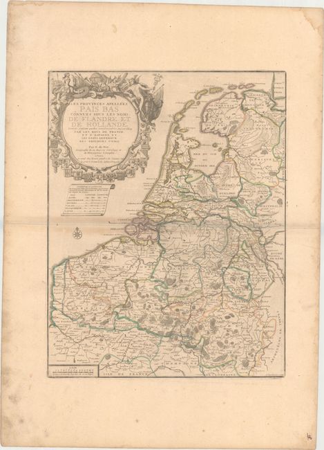
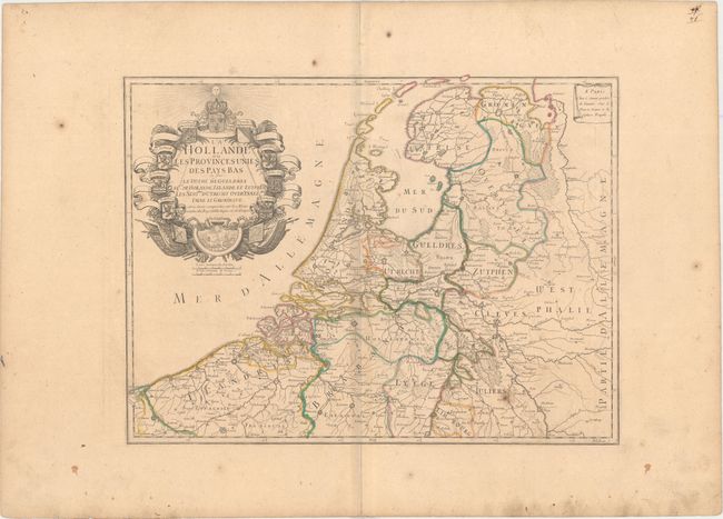
A. Les Provinces Apellees Pais Bas Connues sous les Noms de Flandre et de Hollande..., by Nicolas de Fer, circa 1720 (16.3 x 21.0") and B. La Hollande ou les Provinces Unies des Pays Bas..., by Nicolas de Fer, circa 1720 (20.7 x 15.6"). This pair of maps provides a comparison of the changes in the region that occurred during the War of Spanish Succession. The Low Countries were one of the main theaters of the war. At the conclusion of hostilities the Spanish Netherlands (present-day Belgium and Luxembourg) were transferred to Austria and the Holy Roman Empire while Boulonois, Artois, Cambrai, and part of Hainault was restored to France.
The first map shows the largest extent of the region at the beginning of the eighteenth century when the map was first published. It illustrates the various possessions of France, Spain, and the "United Provinces" of the Dutch Republic. The elaborate title cartouche features Athena, the goddess of wisdom and civilization, at left and Mercury, a messenger and god of trade, at right, with terrestrial and celestial globes between them, and with seventeen coats of arms at bottom. Engraved by P. Starckman. Condition: Original outline color with wide margins on watermarked paper, with light toning along centerfold and some marginal soiling. (B+)
The second map shows the region at the end of the war with the reduced part of the Southern Netherlands that became the Austrian Netherlands. The decorative title cartouche is surrounded by coats of arms of the eight remaining provinces, with the coat of arms of France at top, and a vignette of a battle scene at bottom. Engraved by F. Delapointe. Condition: Original outline color with wide margins on watermarked paper, with light toning along centerfold and a small hole at right. Some marginal soiling. (B)
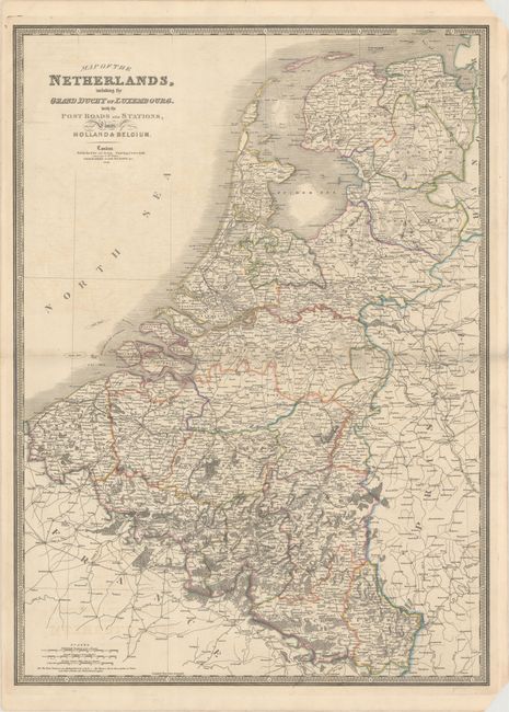
C. Map of the Netherlands, Including the Grand Duchy of Luxembourg..., by James Wyld, dated 1843 (21.9 x 30.3"). A crisp engraving covering all of the Netherlands, Belgium, and Luxembourg, along with portions of France and Germany. The map is filled with fine detail including towns and villages, roads, railroads, rivers, forests and more. Includes three distance scales and surrounded by a keyboard-style border. Condition: Faint offsetting with small chips confined to the top right and bottom right blank margins. (B+)
References:
Condition:
See description above.