Subject: Baltic Sea
Period: 1693 (circa)
Publication: Le Neptune Francais
Color: Black & White
Size:
35.1 x 24.1 inches
89.2 x 61.2 cm
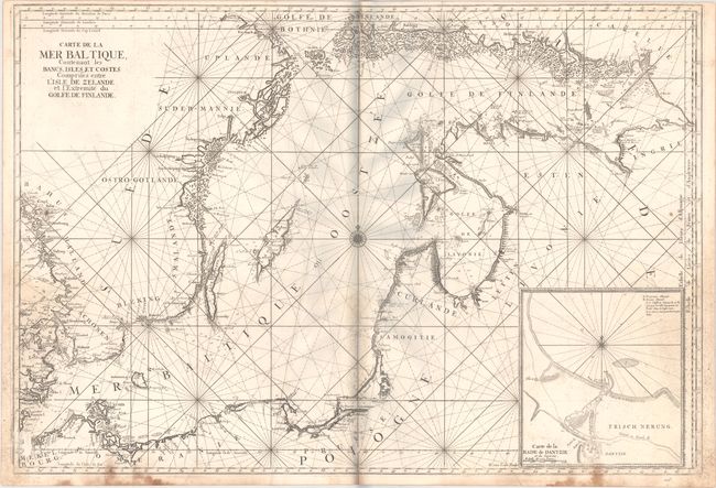
This superb, large sea chart of the Baltic Sea is filled with detail along the coastlines including mountains, cities and forests. A large inset depicts the harbor and entrance to the city of Dantzig. The map is centered on a compass rose with radiating rhumb lines. This chart was initially created for Jaillot's Neptune Francois and subsequently was incorporated into publications by Bellin for the Depot de la Marine. Engraved by Herman van Loon, whose imprint appears adjacent to the inset. An uncommon chart.
References: Pastoureau, NEPTUNE FRANCAIS A [2].
Condition: B
A dark impression with scattered staining that is more prominent along the centerfold and side borders. There is a surface abrasion at lower left with small image loss and an extraneous crease to the left of the centerfold. The grayish hue around the upper centerfold is caused by our scanner and is not on the physical map.