Catalog Archive
Auction 172, Lot 388

"Geographische Vorstellung der Konigreiche Gros Brittannien und Irland", Bodenehr, Gabriel
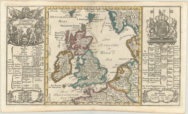
Subject: Britain

Period: 1704 (published)

Publication: Atlas Curieux

Color: Hand Color

Size:
11.8 x 6.8 inches
30 x 17.3 cm
Download High Resolution Image
(or just click on image to launch the Zoom viewer)

A decorative small map of Britain and Ireland that extends to parts of Norway, Denmark, the Netherlands, Germany, Belgium and France. Tables flank the map outlining the political divisions. The superb title cartouche features horses and flags and is balanced by the Royal coat of arms of Great Britain.

References:

Condition: A

A hint of toning along the centerfold and light toning and foxing along the edges of the sheet.

Estimate: $140 - $170

Sold for: $100

Closed on 4/17/2019

Archived