Subject: Caribbean
Period: 1721 (published)
Publication: A New General Atlas…
Color: Hand Color
Size:
23.9 x 20.1 inches
60.7 x 51.1 cm
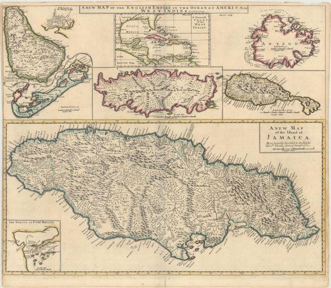
An uncommon large map with eight maps on a single sheet. The major map is of Jamaica with its parishes and very fine detail and notations throughout and an inset map of Port Royal harbor. Arrayed at top are maps of Barbados (with an inset of Bridgetown), the entire West Indies, Antigua, St. Kitts, Tobago and Bermuda. This is a revised version of Christopher Browne's map of 1690 with Senex's imprint in title. Engraved by J. Harris.
References: Shirley (BL Atlases) T.SEN-2a, #32; Palmer (MCC-19) #26; Kapp (MCC-42) #41.
Condition: B+
A crisp impression with contemporary color on paper with the watermarks "HD" and a fleur-de-lis. There is light toning along the edges of the sheet, entering the map border at left due to the very narrow left margin, as issued. Short centerfold separations at top and bottom have been archivally repaired.