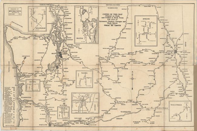
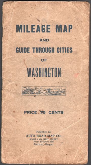
Subject: Washington
Period: 1917 (dated)
Publication:
Color: Black & White
Size:
26.3 x 17 inches
66.8 x 43.2 cm
This unusual cloth map was published by the Auto Road Map Company in Portland, Oregon. It covers the region from Seattle and Portland east to Spokane and Walla Walla and depicts the major road network. Mileages are noted between towns, and several rudimentary insets of city maps are provided to aid in navigation. A table at lower left lists the distances between various cities. Folds into tan paper wrappers (5.0 x 9.4"). A scarce map with no examples located on OCLC or elsewhere.
References:
Condition: B
Issued folding on cloth with light soiling, a few small stains, and some extraneous pencil notations. Paper wrappers are moderately worn and stained.