Subject: Southern Texas
Period: 1876 (dated)
Publication:
Color: Black & White
Size:
15.4 x 10 inches
39.1 x 25.4 cm
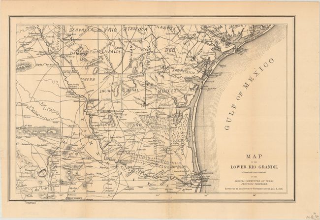
This map was issued as part of a government report concerning cattle theft along the Mexican border. It covers the region of southern Texas and Northern Mexico along the Rio Grande from Fort Duncan to the Gulf of Mexico. The map locates trails, remote villages, ranches, timber stands and features a number of hand-written lithographed notes such as “Paso Selos Arrieros – good food," suggesting that it was rushed to publication. A scarce and unusual map included in some copies of a Congressional report on cattle rustling near the Mexican border. Ultimately, the committee’s report blamed much of the problem on Mexico and urged that U.S. forces be allowed to pursue bandits across the border.
References: Howes #T-143.
Condition: B+
Issued folding and now flattened and backed with tissue to reinforce and repair a few fold separations at bottom. There is a hint of toning along the fold lines.