Subject: Texas
Period: 1870-76 (circa)
Publication:
Color: Hand Color
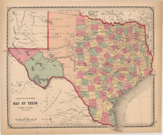
A. Map of Texas, by Warner & Higgins, circa 1870 (17.2 x 13.9"). This uncommon map of Texas was issued in H.H. Lloyd's Atlas of the United States. It presents good detail throughout the settled part of the state, with county configurations current to 1865 (prior to the creation of Hood County from Johnson in 1866). The western third is comprised of the large unsettled areas of Presidio, El Paso, and unnamed Bexar and Young territories. The evolving railroad network is well represented and both the Proposed Southern Pacific Railroad and the U.S. Mail Route are noted. Surrounded by a decorative border. Condition: Light toning along the sheet edges and a few tiny edge tears closed on verso with archival material.
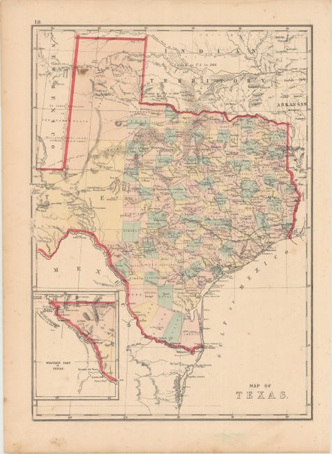
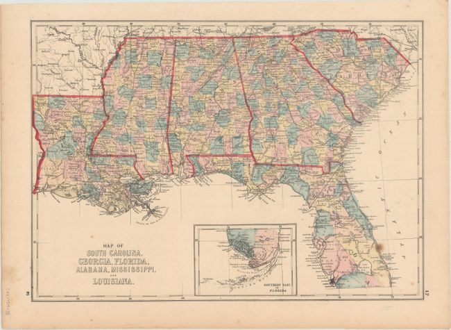
B. Map of Texas [on verso] Map of South Carolina, Georgia, Florida, Alabama, Mississippi, and Louisiana, by Hiram H. Hardesty, circa 1875 (12.2 x 17.0"). A nice map of the state with settlement confined to east of the 101st meridian. Far western Texas is shown in an inset on the same scale. The railroad network extends to Austin and a number of wagon roads are shown crossing the western part of the state. Condition: Light scattered foxing.
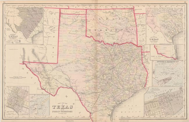
C. Gray's New Map of Texas and the Indian Territory, by Frank A. Gray, circa 1876 (25.6 x 16.5"). Terrific double-page map filled with detail. The state's rapid growth is evident from newly formed counties in the former huge panhandle section of Young Territory. Several railroads abruptly end between cities as the map indicates the exact progress to date. Details include numerous named railroads, cities, towns, watershed, forts, springs, and much more. Seven large insets include city plans for Austin and Galveston, the Entrance to Galveston Bay, and the River Systems. In Indian Territory the Public Lands are limited to the western panhandle. Locates and names the Indian lands of the Kiowa, Comanche, Apache, Chickasaw, Choctaw, Creek, Cherokee, Cheyenne, Osage, and Arrapahoe Tribes. Condition: A hint of toning along the centerfold.
References:
Condition: B+
See description above.