Catalog Archive
Auction 172, Lot 252

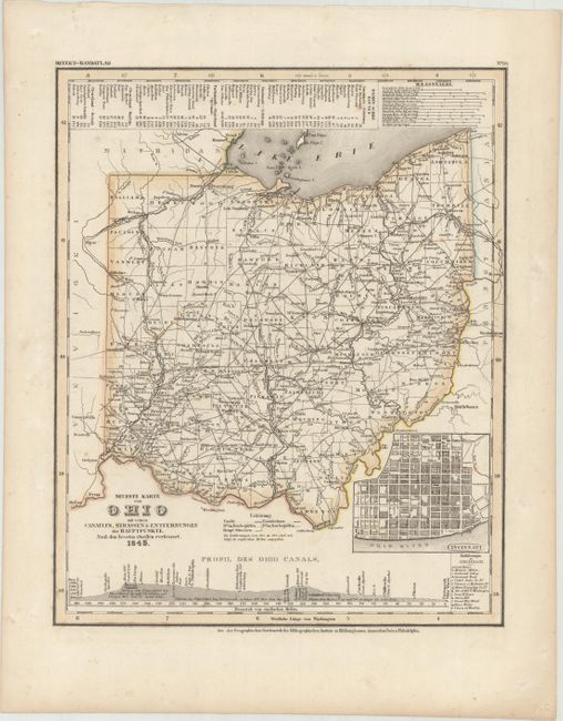
"Neueste Karte von Ohio mit Seinen Canaelen, Strassen & Entfernungen der Hauptpunkte. Nach den Bessten Quellen Verbessert", Meyer, Joseph
Subject: Ohio

Period: 1845 (dated)

Publication: Meyer's Hand-Atlas...

Color: Hand Color

Size:
11.8 x 14.6 inches
30 x 37.1 cm
Download High Resolution Image
(or just click on image to launch the Zoom viewer)

Fine early map showing counties, roads, railroads, canals and settlements. Includes an inset bird's-eye plan of Cincinnati and a profile view of the Ohio Canal. Toledo is depicted in Michigan despite the fact that Ohio had gained the strip of land that included this city in 1836 as the result of the infamous Toledo War. County configuration is up to date for 1831, just prior to the organization of Lucas and Carroll Counties. The steamship routes are given in a table at top. Published by the Hildburghausen Biblio Institut. This map was copied from Henry Tanner's Universal Atlas.

References:

Condition: A

Contemporary color with minor foxing and soiling mostly confined to the blank margins.

Estimate: $100 - $130

Sold for: $75

Closed on 4/17/2019

Archived