Subject: New York City, New York
Period: 1842-80 (circa)
Publication:
Color: Hand Color
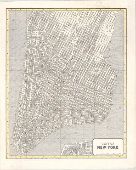
A. City of New York, by Morse & Breese, dated 1842 (11.9 x 14.8"). This early cerographic map was published in Morse'e North American Atlas. It focuses on lower Manhattan and shows good detail of the street grid pattern, parks, and docks. Condition: There is a small abrasion in the top blank margin, else fine. (A)
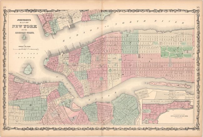
B. Johnson's Map of New York and the Adjacent Cities, by Johnson and Ward, circa 1862 (25.9 x 16.0"). A nice double-page map of lower Manhattan to Central Park that extends to include portions of Brooklyn and Jersey City. An inset extends to show upper Manhattan. Condition: There is a short centerfold separation at bottom that has been archivally repaired on verso and light toning along the sheet edges and centerfold. (B+)
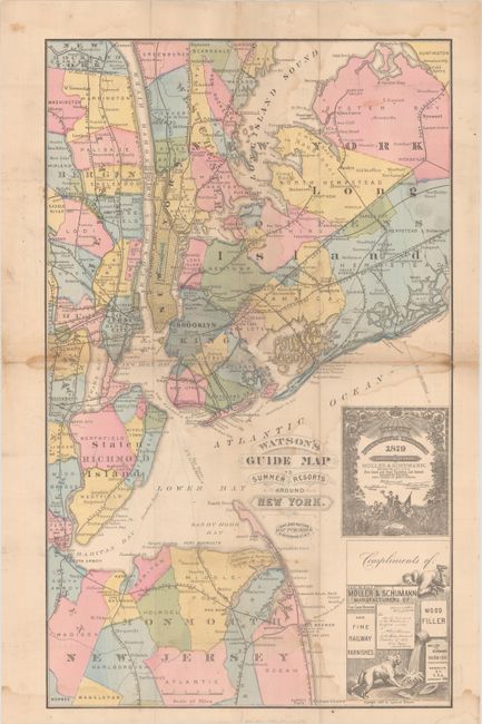
C. Watson's Guide Map to Summer Resorts Around New York, by Gaylord Watson, dated 1880 (13.3 x 21.8"). This pocket map was published by Moller & Schumann manufacturers with two advertisements printed in the lower right corner of the sheet. The map extends from Ocean Grove on the Jersey shore to above Dobb's Ferry on the Hudson and locates scores of resorts, towns, and villages. Provides excellent detail of the railroads throughout the region. On the verso are additional advertisements for Moller & Schumann. Condition: Issued folding with dampstains and a few small fold separations. (B)
References:
Condition:
See description above.