Catalog Archive
Auction 172, Lot 236

"New Map of Boston, Comprising the Whole City, with the New Boundaries of the Wards...", Boynton, George W.

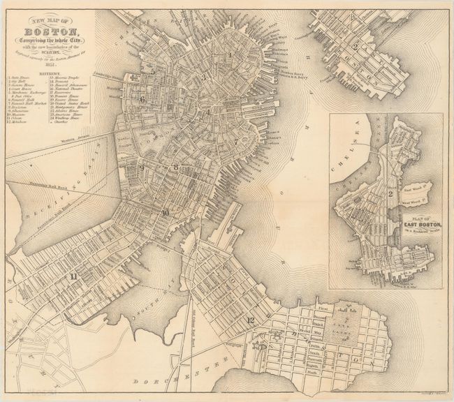
Subject: Boston, Massachusetts

Period: 1851 (dated)

Publication: The Boston Almanac

Color: Black & White

Size:
10.9 x 9.5 inches
27.7 x 24.1 cm
Download High Resolution Image
(or just click on image to launch the Zoom viewer)

This bird's-eye plan shows the city before part of the Receiving Basin was filled to create Commonwealth Avenue and Back Bay neighborhood. A large inset depicts a "Plan of East Boston." The map is very finely engraved, likely on steel, and has a reference locating 24 important places.

References:

Condition: B+

Issued folding, printed on banknote style paper, with light toning and a couple of tiny separations along the folds.

Estimate: $160 - $190

Sold for: $120

Closed on 4/17/2019

Archived