Subject: Chicago, Illinois - Atlases
Period: 1924 (dated)
Publication:
Color: Hand Color
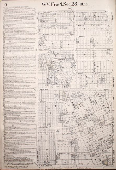
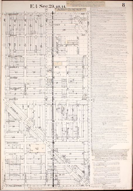
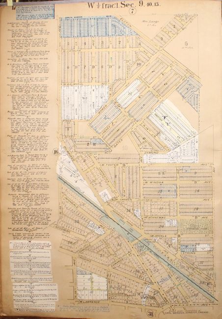
These large, elephant folio atlases are a remarkable find. Real estate, title, and insurance companies used these atlases. They were usually discarded when they became outdated and are quite scarce outside of public institutions. Each commercial atlas contains maps measuring approximately 19 x 28", plus an Index Map with a key to the individual maps. The maps are a graphic depiction of the city with each street map including extensive notes on each property related to sub-division, property owner, survey notes, additions, changes, water mains, sewers, and rail lines. All maps are drawn on a common scale of 200 feet per inch.
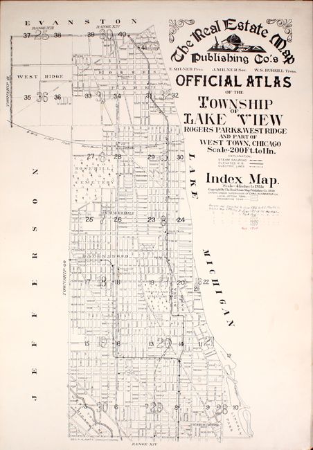
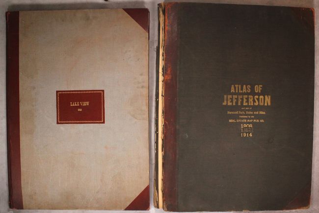
A. The Real Estate Map Publishing Co.'s Official Atlas of the Township of Lake View Rogers Park & West Ridge and Part of West Town, Chicago, by Chas. H. Hawkins (21.3 x 29.9"). This atlas includes 41 single-page street plans and 2 key maps depicting the area along Lake Michigan between Fullerton Avenue and Howard Street at the northern end of Rogers Park. Dated 1909, there are multiple sets of manuscript revisions through November, 1924 as noted on the title page, which are pasted in on the maps throughout the atlas. Hardbound in grey cloth with gilt red cloth label and red cloth spine and tips. Condition: The maps are overall clean and bright with light soiling at the bottom corner where the pages are turned. Covers are moderately soiled with a few abrasions and bumped corners. (A)
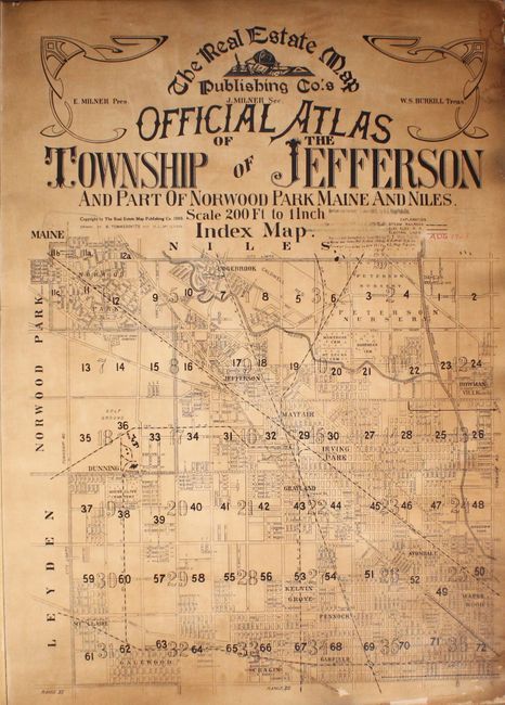
B. The Real Estate Map Publishing Co.'s Official Atlas of the Township of Jefferson and Part of Norwood Park Maine and Niles, by B. Tomassovits and H.L. McIlvain, (22.6 x 30.5"). This atlas includes 74 single-page street plans and 1 key map depicting the area east of O'Hare airport, bounded by North Oak Park Avenue (here called N. 72nd Avenue) in the west, W. Devon Avenue in the north, North Western Avenue in the east, and W. North Avenue in the south. Dated 1908, there are multiple sets of manuscript revisions through August, 1924 as noted on the title page, which are pasted in on the maps throughout the atlas. Hardbound in quarter red leather and tips over black cloth covers with gilt titling on front cover. Condition: The maps are lightly toned and soiled with damp stains along the bottom edge. The title page is heavily toned and soiled. The spine is perished and the covers are detached. The back cover is slightly warped and both covers have moderate soiling, some abrasions, and small chips to the leather, but are still usable for rebinding. (B)
References:
Condition:
See description above.