Subject: Florida
Period: 1849 (dated)
Publication:
Color: Hand Color
Size:
25.2 x 22.1 inches
64 x 56.1 cm
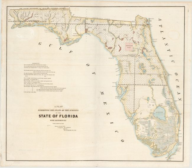
An interesting and detailed early lithographed map representing the progress of surveying in the state. The Everglades, Big Cypress, Arredondo Grant, Forbes Purchase and numerous forts are clearly shown. It extends to show Key Largo, here named as Cayo Largo. The map is filled with detailed notes related to surveys and townships. This map was produced in a period of relative peace between the U.S. and Seminole Nation. The third and final Seminole War waged between 1855 and 1858. Issued from St. Augustine by R.A. Putnam, Surveyor General, dated September 30, 1849.
References:
Condition: B+
Issued folding, now flattened with minor extraneous creasing, a few light stains, and a small chip and tear in the left blank margin that have been archivally repaired.