Subject: Florida & Bahamas
Period: 1865 (dated)
Publication:
Color: Black & White
Size:
48 x 38.4 inches
121.9 x 97.5 cm
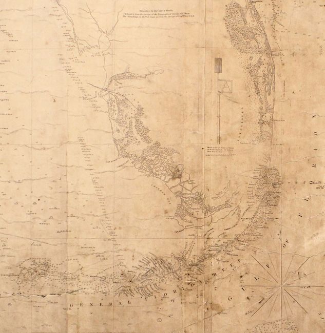
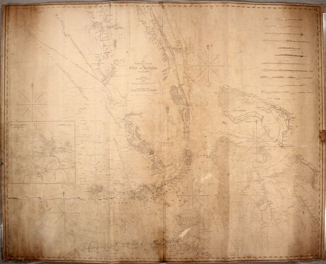
This impressive, two-sheet "blueback" chart covers much of Florida including the Keys and Dry Tortugas, the northern coast of Cuba, and part of the Bahamas. It was first issued in Blunt's 1827 maritime atlas and has been updated and significantly improved based upon the survey work of Colonel Abert (Topographical Engineers) and Commander Powel (Navy), with additions to 1865. The nautical information includes scores of soundings, hazards, currents, sea floor types, lighthouses, notes and exceptional coastal detail. Features an inset of Key West Harbor by A.D. Bache, 12 coastal approach views, and 5 compass roses to aid in navigation. Backed with stiff blue paper.
References:
Condition: C
This working chart shows signs of heavy use, with moderate toning, heavy soiling, and a few pencil notations. There is an 18" tear extending from the left edge of the map that is in need of repair, as well as a few minor tears and chips along the edges of the sheet.