Subject: Central United States
Period: 1915 (circa)
Publication:
Color: Printed Color
Size:
35.6 x 37 inches
90.4 x 94 cm
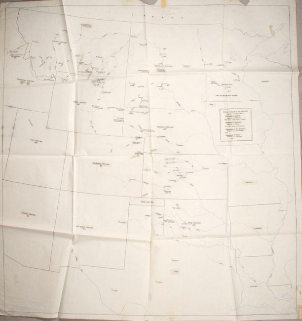
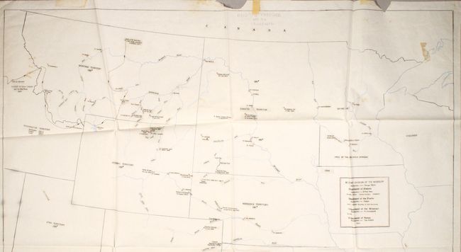
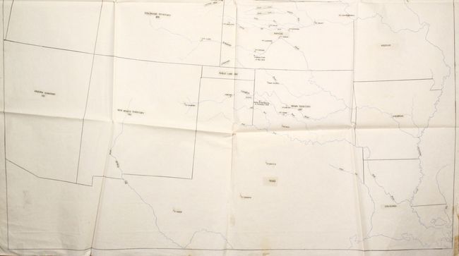
This unusual manuscript map was traced on sturdy onionskin paper sometime in the early 20th century. State and territorial boundaries are drawn in colored pencil along with printed name labels and dates of creation neatly pasted onto the sheet. The map covers the entire central United States from Louisiana west to Arizona and north to the Canadian border. Additional information related to Indian battles are also provided including the track of the pursuit of Chief Joseph, the sites where Sitting Bull and Crazy Horse were killed, Little Big Horn, and more. A remarkable depiction of the U.S. Army’s history of engagements on the frontier.
References:
Condition: B+
Folding with two chips at top, including one that just enters the map border. There is an old tape repair at top and a few old tape stains visible on recto.