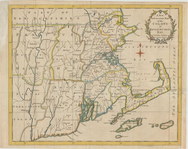
Subject: Colonial New England United States
Period: 1780 (published)
Publication: Universal Magazine
Color: Hand Color
Size:
12.8 x 10.4 inches
32.5 x 26.4 cm
This Revolutionary War era map focuses on Massachusetts and also covers all of Rhode Island and parts of Connecticut and New Hampshire. Handsomely adorned with a wreath-style title cartouche and delicate compass rose, it provides a good view of the towns, roads, early counties, as well as rivers, ponds and waterfalls. The maps issued in the Universal Magazine are among the best executed and attractive of the British magazine maps, this being no exception. These maps were issued during a crucial point in history and provided the British public with up-to-date information on the war in America.
References: Jolly #UNIV-190; McCorkle #780-12; Sellers & Van Ee #881.
Condition: B+
Issued folding on watermarked paper with a bit of faint offsetting. There is a short binding tear at right that just enters the border that has been closed on verso with archival material.