Subject: Eastern United States
Period: 1852 (dated)
Publication:
Color: Black & White
Size:
61.5 x 25.4 inches
156.2 x 64.5 cm
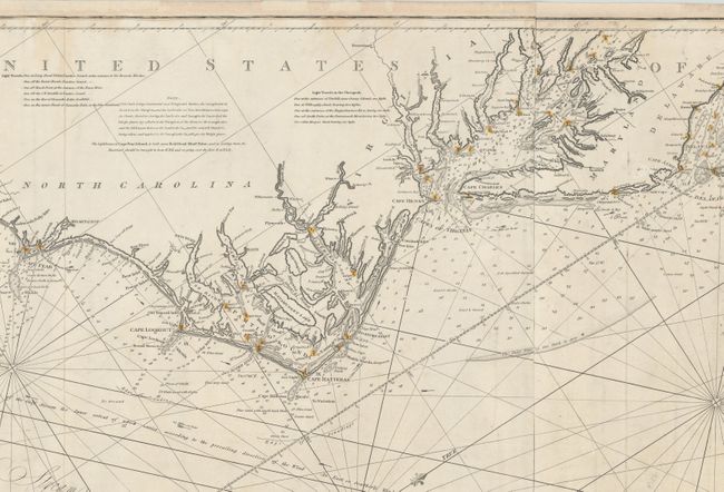
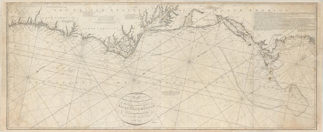
This rare, large-scale, blue-backed chart covers the eastern coast of the United States from St. Mary's inlet in Georgia to Penmanquid Point in Maine. Oriented with north to the right, the chart is densely engraved with navigational information including shoals, tidal directions, the gulf stream, soundings, and bottom textures. The numerous lighthouses are graphically illustrated with each hand-colored in red and yellow. Engraved by J. Stephenson, this is Norie's New Edition of William Heather's chart of 1799. It was first issued in 1834, with this example updated to 1852.
John Norie (1772-1843) was a hydrographer, chart publisher, teacher and author of navigation manuals. He started out as a draftsman for William Heather, whom he succeeded in 1812. Their business, located at 157 Lendenhall Street in London, became known as Naval Academy or Naval Warehouse. This preeminent cartographic firm exists today as Imray, Laurie, Norie & Wilson Ltd, still specializing in nautical charts.
References:
Condition: B+
Light soiling with some staining along the left and right sheet edges. There are expert repairs to several edge tears and chips mostly at left and right, with a portion of the border drawn in facsimile. An overall very good example for a working navigational chart.