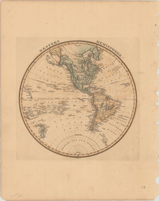
Subject: Western Hemisphere - America
Period: 1823 (circa)
Publication: A General Atlas Containing Distinct Maps Of all the Known Countries in the World...
Color: Hand Color
Size:
8.9 x 8.8 inches
22.6 x 22.4 cm
This map of the Americas extends to include New Zealand and several Pacific islands. The United States is bounded to the west by the Mississippi, with a vast Louisiana to the west of the river. New Mexico, New Albion, and Quivira appear in the west. There is no northernmost boundary delineated in North America. A Barrier of Ice is noted to the north of Alaska's Icy Cape. In Hawaii, Captain Cook's death is noted. Sandwich Land is depicted as a fragment of coastline. Engraved by Henry Schenck Tanner.
Fielding Lucas, Jr. was a successful cartographer and map publisher in Baltimore. Lucas is best known for his General Atlas of 1823, which is considered one of the finest general atlases produced in the U.S. at the time, due to the high quality paper, superior engraving quality, and attractive coloring style.
References:
Condition: B+
Original color with light toning and offsetting.