Subject: Western Hemisphere - America
Period: 1754 (dated)
Publication: Atlas Methodique...
Color: Hand Color
Size:
20 x 19.5 inches
50.8 x 49.5 cm
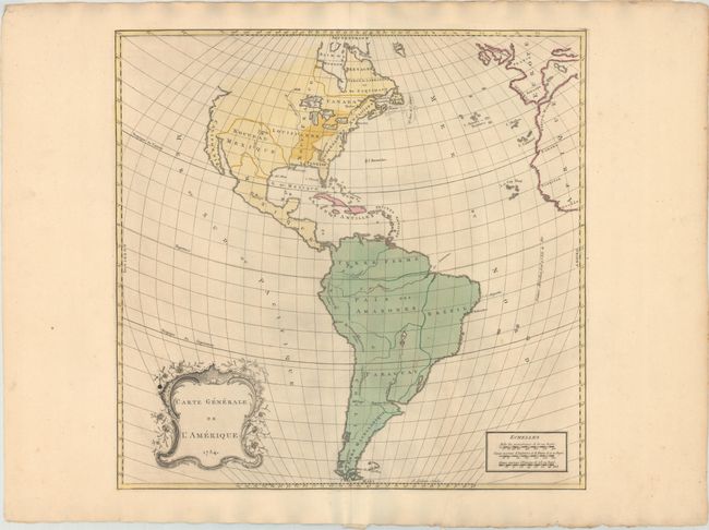
This elegantly engraved map of the Americas was published near the start of the French and Indian War. English possessions are confined to the east coast. There is a massive Louisiane territory, and the area around the Mississippi is labeled Nouv. France. Spanish Florida is delineated with its southern tip depicted as a grouping of smaller islands. The present-day American Southwest is Nouveau Mexique. Peninsular California is named as well. The northwestern part of North America is left undefined. Only two cities are identified in the present-day United States: Boston and Santa Fe. Quebec City, at that time the capital of New France, is noted. South America is divided into Terre Ferme, Peru, Pais des Amazones, Brazil, Chile, Paraguay, and Terre Magellanique. There is an ornate title cartouche at bottom left. Engraved by John Gibson.
Palairet was born in France but fled to England where he became a French tutor to King George II’s children.
References: Phillips (Atlases) #3502-12.
Condition: B+
Original color on a watermarked sheet with a few light spots.