Subject: Romania & Bulgaria
Period: 1741 (published)
Publication: Description Exacte de l'Univers, ou l'Ancienne Geographie Sacree et Profane
Color: Hand Color
Size:
18.3 x 13.9 inches
46.5 x 35.3 cm
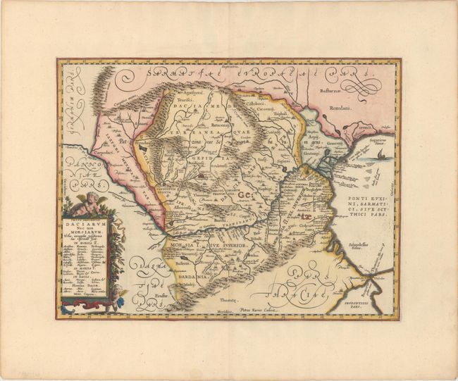
Impressive map of the area of Romania and Bulgaria that is centered on the Danube River. The map is based on Ortelius' map of the region, which was in turn based on classical sources. It was beautifully engraved by Petrus Kaerius to highlight the major cities, mountains and rivers and is embellished by a garland-draped title cartouche with two putti, a compass rose, and an oared ship in the Black Sea. Blank verso, published in Pieter de Hondt's Description Exacte de l'Univers, ou l'Ancienne Geographie Sacree et Profane, a French edition of Georgius Hornius' Accuratissima Orbis Antiqui Delineatio, which included maps from Johannes Jansson's historical atlas and Abraham Ortelius' Parergon.
References: Van der Krogt (Vol. I) #7710H:1.
Condition: A
A sharp impression on a clean, bright sheet with minor creasing in the top blank margin.