Subject: England & Wales
Period: 1690 (circa)
Publication:
Color: Hand Color
Size:
34.3 x 22.9 inches
87.1 x 58.2 cm
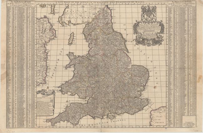
This densely detailed map shows all of the roads, post roads, cities and market towns throughout England and Wales, with distances between cities marked within small circles along each route. Berry appears to have copied John Adams' more decorative map from 1679. The columns flanking the map identify the county, market day, distance from London, and location on the map of hundreds of cities, as explained in the drape-style cartouche at bottom left. The lovely title cartouche features the Royal coat of arms. This is the second state with the dedication updated to honor William III. Printed on two sheets, joined as issued.
References: Shirley (BI to 1750) Berry 2.
Condition: B
A nice impression with contemporary outline color, several small stains, a few tiny repaired holes along the folds, and some short edge tears at right and left that have been closed on verso (most with archival materials but a couple with non-archival materials), entering less than 2" into image.