Subject: England, France
Period: 1928 (published)
Publication:
Color: Printed Color
Size:
7.6 x 5.7 inches
19.3 x 14.5 cm
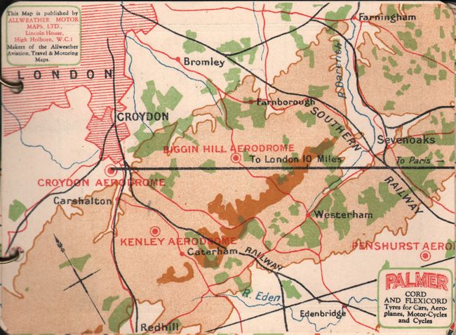
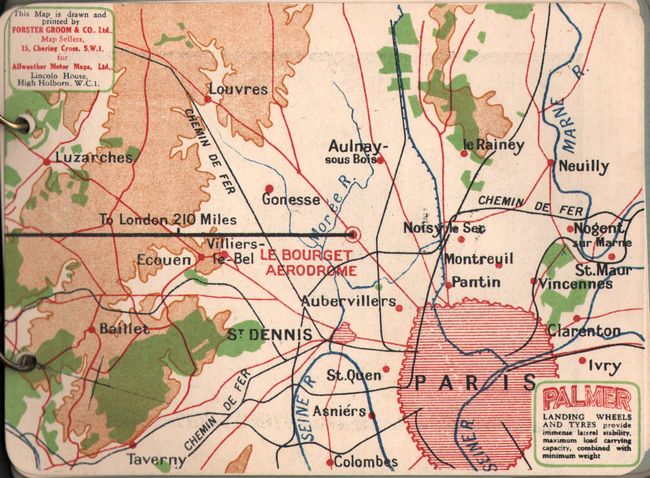
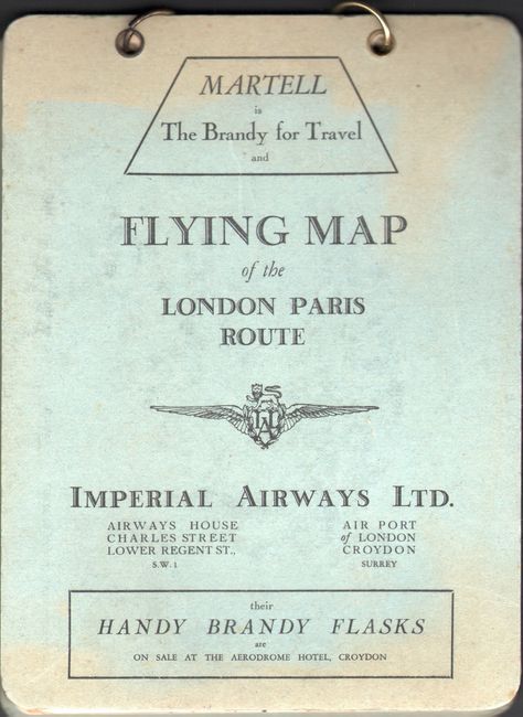
This very rare vintage flip map is one of the earliest air navigation maps and was designed for passengers flying British Imperial Airways' 225-mile route from London to Paris. One of the first long-range airlines, British Imperial Airways (1924-39) was the forerunner of British Airways. Bound in a ring-binder for easier handling, the ten heavy card-stock route maps provided airline passengers with the ability to follow along with their flight path, which is marked off in ten mile increments. Additional notes indicate specific sights to look for during the flight. There are also friendly tips to ease a passenger's concern about flying, such as an explanation of why bumps might occur on the flight, how to clear your ears due to the change in atmospheric pressure, and the fact that the airplane and engine were designed and built by the British and are flown by British pilots. On the verso of each map is a contemporary advertisement for items such as loud speakers, batteries, and biscuits. Published in London by All-Weather Motor Maps, Ltd.
References:
Condition: A
The maps are clean and bright, and the covers are partially sunned with light soiling.