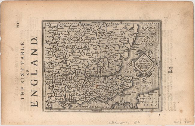
Subject: Southeastern England
Period: 1635 (circa)
Publication: Historia Mundi or Mercators Atlas...
Color: Black & White
Size:
7.1 x 5.4 inches
18 x 13.7 cm
Appealing small map of southeastern England including London, Salisbury, Oxford, Cambridge, Leicester, and Norwich and the Isle of Wight. The map is filled with minutely engraved detail and is graced with two strapwork cartouches and a moiré patterned sea. This example appeared in the English edition of Mercator's Atlas Minor, which was published under the title Historia Mundi or Mercators Atlas by Michael Spark and Samuel Cartwright. After acquiring the plates to the 1607 edition of the Mercator/Hondius Atlas Minor, Sparke republished the maps with text translated into English by Wye Saltonstall. English text on verso, with two sheets of related English text included in the lot.
References: Van der Krogt (Vol. III) #5114:351.
Condition: B+
On a watermarked sheet with light printer's ink residue and a few small spots, including a rust spot. There is light soiling and toning that is mostly confined to the sheet's margins.


