Catalog Archive
Auction 171, Lot 409

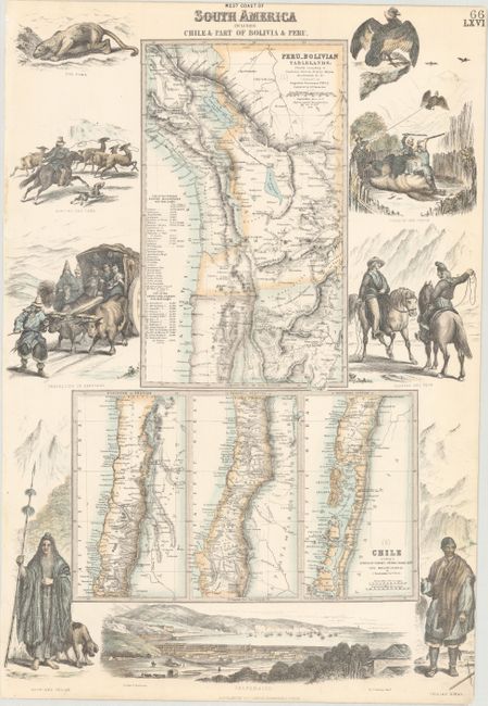
"West Coast of South America Including Chili & Part of Bolivia & Peru", Fullarton, Archibald & Co.
Subject: Western South America

Period: 1860 (circa)

Publication: The Royal Illustrated Atlas

Color: Hand Color

Size:
12.5 x 18.4 inches
31.8 x 46.7 cm
Download High Resolution Image
(or just click on image to launch the Zoom viewer)

This sheet contains four maps encompassing the western coast of South America from southern Peru to Taitao Peninsula in Chile. The top map includes charts of the principal mountains and passes in the region with their heights. The maps are surrounded with vignettes of regional figures and animals, as well as a view of Valparaiso. Drawn and engraved by J. Dunlop.

References:

Condition: A

Attractive color on a clean sheet.

Estimate: $100 - $130

Sold for: $55

Closed on 2/6/2019

Archived