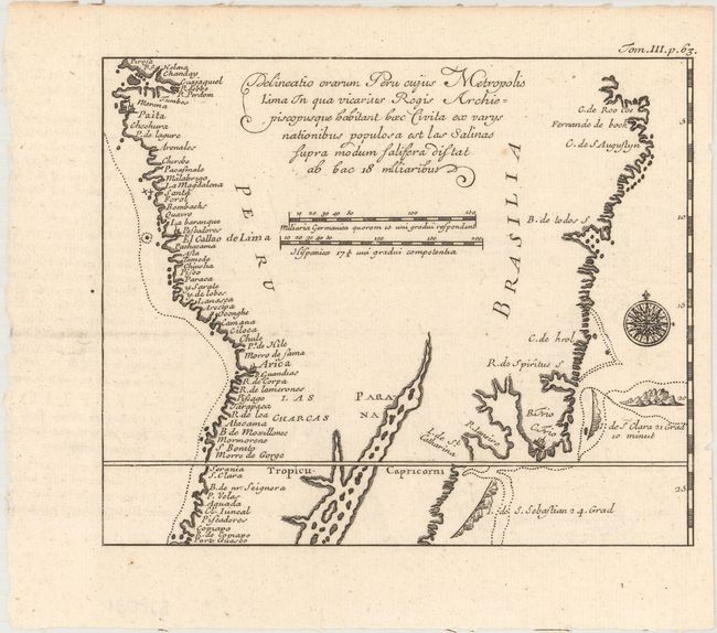
Subject: Central South America
Period: 1725 (published)
Publication: Recueil des Voyages...
Color: Black & White
Size:
6.5 x 5.4 inches
16.5 x 13.7 cm
Oliver van Noort was an explorer and the first Dutchman to circumnavigate the world. In 1598, he set out with four ships with the intent to attack Spanish possessions in the Pacific, conduct trade with China and the Spice Islands, and circumnavigate the globe. Van Noort completed the voyage, losing three ships and over 200 men along the way, and chronicled his travels in Description du Penible Voyage Faict entour de l'Univers ou Globe Terrestre, first published in 1602. The book featured maps of central and southern South America, which depict some of the earliest and most detailed maps of the western coastline of the continent. Van Noort's account was republished in 1703 by Constantin Renneville in Recueil des voyages qui ont servi a l'etablissement et aux progres de la Compagnie des Indes Orientales with re-engraved maps.
This 1725 edition map shows the western coastline from the Gulf of Guayaquil in Ecuador to Copiapo, Chile, with numerous place names. The eastern coastline extends from north of Cabo de Santo Agostinho and Recife to the Ilha de Sao Sebastiao, just east of Sao Paulo. Van Noort's track is shown in the Atlantic, with landfall near Rio de Janeiro, as well as in the Pacific, extending the length of the coast. The size of the Parana River is quite exaggerated, dotted with small islands. A fascinating map detailing this early Dutch exploration.
References: Shirley (BL Atlases) G.COMM-3a #20.
Condition: A
A dark impression on a clean sheet. Issued folding.


