Subject: World
Period: 1817 (dated)
Publication:
Color: Hand Color
Size:
23.4 x 18.3 inches
59.4 x 46.5 cm
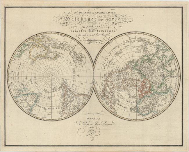
This uncommon German double-hemisphere world map shows the world on a polar projection. The eastern coast of the United States is labeled Vereini-Staten, and the middle of the country is identified as Louisiana. Neu Mexico, Neu Albion, and Neu Georgien appear in the west, and Taxas is named. In general, the cartography of the coast of northwestern North America is rudimentary. The northernmost boundary of North America is conjectural, indicated by a dotted line. Captain Cook's death is noted in Hawaii. In China, the Great Wall is depicted. There is no sign of Antarctica, with the closest discovery being a fragment of Cape Circoncision, discovered by Jean-Baptiste Charles Bouvet de Lozier in 1739.
References:
Condition: A
Issued folding with some minor printer's ink residue.