Subject: World
Period: 1808 (dated)
Publication:
Color: Hand Color
Size:
17.3 x 13.2 inches
43.9 x 33.5 cm
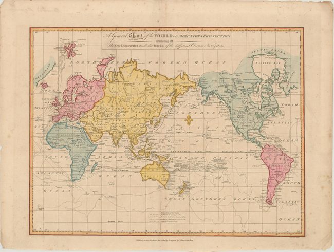
This chart of the world outlines the tracks of Captain Cook on his three major voyages of exploration. A key at bottom identifies the tracks of the Endeavour from 1768-71, the Resolution and Adventure from 1772-75, and the Resolution and Discovery from 1776-80. The voyage of the HMS Racehorse and HMS Carcass, commanded by Constantine John Phipps in 1773, is also shown, depicting his attempt at finding a northwest passage from the Atlantic Ocean to the Pacific Ocean. In North America, the northwest coast is not yet fully delineated, and a River of the West is shown to the east of Nootka Sound. California is labeled New Albion. Australia is named New Holland with numerous new discoveries by Cook. Diemens Land is no longer connected to the mainland, as this chart was published in the decade following the discovery of Bass Strait by George Bass and Matthew Flinders. There is no sign of Antarctica, except for Sandwich Land at the 60th Parallel. This chart was engraved by Samuel John Neele and appeared in various publications starting in 1795, including Rev. John Malham's Naval Gazetteer and Atlas to Crutwell's Gazetteer. Published by Longman & Co.
References:
Condition: B+
There is faint toning, minor foxing mostly confined to the blank margin, and a 3.5" tear in the bottom left corner that has been closed on verso with archival tape.