Subject: South Carolina
Period: 1753-79 (published)
Publication:
Color: Black & White
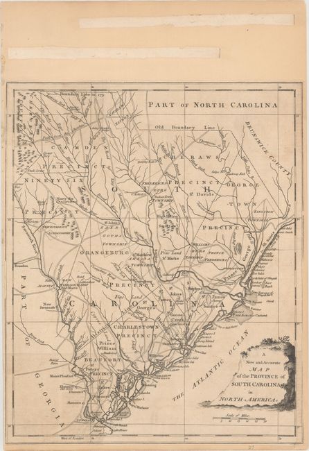
A. A New and Accurate Map of the Province of South Carolina in North America, by Anonymous, from Universal Magazine, published 1779 (10.8 x 13.1"). There is a vast amount of information on this uncommon map of South Carolina including precincts, townships, towns, forts, Indian villages and reservations, roads and trails, ferries, courthouses, landmarks, swamps, rivers, creeks, harbors, islands and shoals. The border with North Carolina is marked both Boundary in 1772 and Old Boundary Line. Even though the Board of Trade in London ordered the first survey of the boundary line in 1730, the royal governors of the two colonies took seven years to choose the surveyors - none of whom had any surveying experience. The men were directed to follow a northwestern course, from an agreed-upon point on the coast, until they reached the 35th parallel and then to go due west. After months of battling swamps and other hardships the surveyors quit 11 miles south of the 35th parallel. In 1764, after the Catawba Indian’s 15-miles-square reservation was agreed upon in the Treaty of Augusta, another surveying party was ordered to pick up where the earlier group had stopped. Instead of taking the boundary line 11 miles to the north, as originally instructed, the second party went due west for 62 miles before stopping at a place now known as Old North Corner. It was not until 1772 that commissioners and surveyors from both colonies were appointed to run a revised line, which in fact just carried on in a northwestern course from the Old North Corner to a point about 11 miles north of the 35th parallel (in order to make adjustment for the previous error that resulted in a loss of territory for South Carolina). The line then proceeded west and ended at the Cherokee Line. Condition: Issued folding and now backed on a heavy sheet of old paper. Trimmed to just inside the neatline at right with two tears that extend 3" and 0.5" into the image.
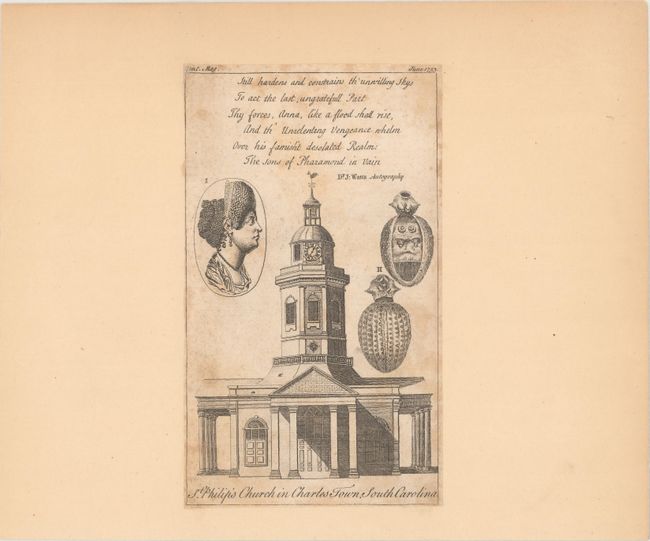
B. St. Philip's Church in Charles Town, South Carolina, from Gentleman's Magazine, published 1753 (4.3 x 7.3"). An attractive engraving from the June 1753 edition of the magazine. Condition: Backed on a heavy sheet of old paper with scattered foxing.
References: Jolly #UNIV-180; Sellers & Van Ee #1523.
Condition: B
See description above.