Subject: Adirondacks, Northeastern New York
Period: 1888 (dated)
Publication:
Color: Hand Color
Size:
25.3 x 31.9 inches
64.3 x 81 cm
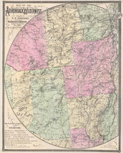
Stoddard's famous and popular Adirondack pocket map was first published in 1880 and revised annually into the first decade of the 20th century. This example is the 10th revised edition,e ngraved and printed by L.E. Neuman, & Co. for the New York Forest Commission. The finely engraved map extends from the eastern edge of Lewis, Croghan, Watson, and Greig counties all the way to Lake Champlain in the east, south to show part of Saratoga and Fulton counties, and north to include Franklin, Clinton and St. Lawrence counties. It has good detail throughout including political boundaries, towns and villages, roads, railroads, lakes, watershed, and topography. Railroad, stage, and steamboat fares are printed beside each route. Major rivers stretch beyond the map's circular boundary. Surrounded by decorative border, blank on verso.
References:
Condition: B+
A clean and bright example with a dark impression. There are several fold separations and small tears and holes, most of which have been backed in archival materials on verso.