Subject: New York
Period: 1831 (dated)
Publication: American Atlas
Color: Hand Color
Size:
21.4 x 16.9 inches
54.4 x 42.9 cm
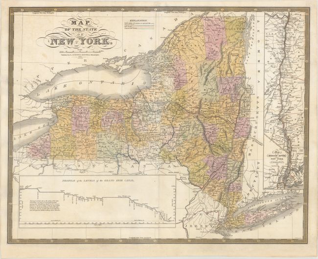
This is the first edition of Mitchell's map of Pennsylvania that was included in his American Atlas. Mitchell purchased the plates from Anthony Finley and subsequently published them under his name. The map is finely engraved and shows the county configurations in full color with good detail of towns, roads, railroads, canals and rivers. It includes a profile of the Erie Canal at bottom and an inset of the Hudson River from New York to Albany at right. Surrounded by a keyboard-style border. Engraved by James Young.
References:
Condition: B+
On watermarked paper with professional repairs to a few centerfold separations and edge tears at right and left that enter approximately 2" into the image. Light offsetting with several edge chips that have been professionally repaired on verso.