Subject: St. Paul, Minnesota
Period: 1874 (published)
Publication: Illustrated Historical Atlas of the State of Minnesota
Color: Hand Color
Size:
26.4 x 16.6 inches
67.1 x 42.2 cm
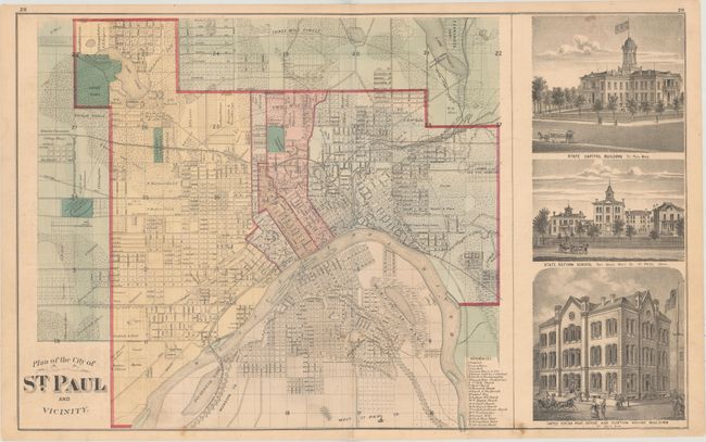
This detailed city plan comes from Alfred T. Andreas' landmark Minnesota atlas. It highlights 22 important buildings and is flanked by views of the Capitol Building, State Reform School, and the U.S. Post Office and Custom House Building. The verso of the plan is filled with several illustrations of the businesses in St. Paul.
A.T. Andreas' atlas was sold by subscription to prominent landowners throughout the state. He chose Minnesota because the state was young, the population was affluent, and the eastern mapmakers had not yet worked the area. He brought together the production facilities in Chicago, canvassers to sell subscriptions, surveyors to create plat maps, writers to produce the written materials, and artists to draw portraits and illustrations of cities and farms. The result was a comprehensive and intimate portrait of the state and is a wealth of historical information today.
References: Phillips (A) #2007; Ristow, pp. 433-439.
Condition: B+
There are a few small spots, some minor toning, and a small hole to the left of the centerfold at bottom.