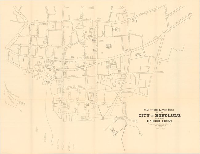
Subject: Honolulu, Hawaii
Period: 1893 (dated)
Publication: U.S. 53rd Cong. 2nd Session. House of Representatives. Exec. Doc. No. 47
Color: Black & White
Size:
28.7 x 22.5 inches
72.9 x 57.2 cm
This rare and intricately detailed plan of downtown Honolulu by Albert Braun Loebenstein was published the same year a group of mostly American sugar planters and businessmen overthrew the Hawaiian monarchy. It is one of the first available printed maps to focus on Honolulu. The plan accurately details the streets and harbor, even specifying ships in the harbor by name and, in most cases, date of arrival. Notable locations are identified, including the former royal palace, Aliiolani Hale (now home to the Supreme Court of Hawaii), a music hall, and the Honolulu Market. The railway wharf for the Oahu Railway & Land Co., Hawaii's first railroad, is shown at the west end of the harbor.
Loebenstein (1857-1907) was a land surveyor and civil engineer who emigrated to the Kingdom of Hawaii in the 1880s. There he established a successful private consulting operation and was given regular work by the Hawaii Survey Office. Despite working for fellow Americans on the island, he supported the toppled Hawaiian monarchy and opposed the American annexation of Hawaii in 1898 (although he later became a member of the territorial legislature). That same year, he authored a plan for the redevelopment of the Honolulu Harbor.
References:
Condition: A
Issued folding with a few tiny splits at fold intersections.


