Subject: Los Angeles, California
Period: 1903 (dated)
Publication:
Color: Printed Color
Size:
30 x 36.9 inches
76.2 x 93.7 cm
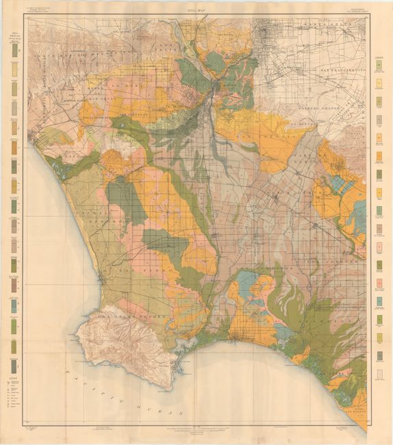
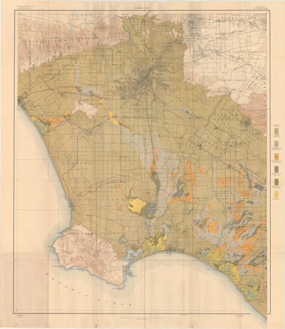
A great pair of maps drawn on the same base map, and issued in the 5th Report of the Field Operations of the Bureau of Soils under the direction of Milton Whitney. The area covers the Los Angeles Basin to include parts of Los Angeles and Orange counties. The maps shows the cities and roads between the Santa Monica Mountains, Santa Anita, La Bolsa Chica (today's Huntington Beach), and Los Palos Verde, the site of today's Rancho Palos Verde. Includes excellent detail of the rapidly growing region on a scale of 1 mile to the inch. Both are beautifully colored to match their respective legends. The soil map lists 34 different soil types, each with its unique color and pattern. The alkali map indicates six different degrees of alkalinity, again via color and pattern. A nice pair of large detailed maps of the Los Angeles area.
References:
Condition: B+
Issued folding with light toning, minor foxing, and a few tiny splits at fold intersections.