Subject: Northern Arizona, Southern Utah, Grand Canyon
Period: 1882 (published)
Publication:
Color: Printed Color
Size:
17.8 x 28.8 inches
45.2 x 73.2 cm
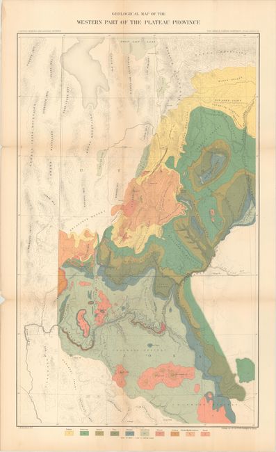
This map was issued in the quarto edition of Dutton's Atlas to Accompany the Monograph on the Tertiary History of the Grand Canon District - one of the most important works on the region ever produced. It covers the region from the Great Salt Lake to the Colorado Plateau with the Grand Canyon roughly at center. The map colorfully presents 10 different geological types including Tertiary, Cretaceous, Jurassic and Basalt with underlying details of topography and drainage. Lithographed by Julius Bien & Company.
References:
Condition: B+
Issued folding with a few small fold separations that have been closed on verso with archival tape, resulting in minor loss at two fold intersections. Light toning along the fold lines.