Subject: Arizona
Period: 1896-1907 (dated)
Publication:
Color: Printed Color
Size:
16.8 x 20.3 inches
42.7 x 51.6 cm
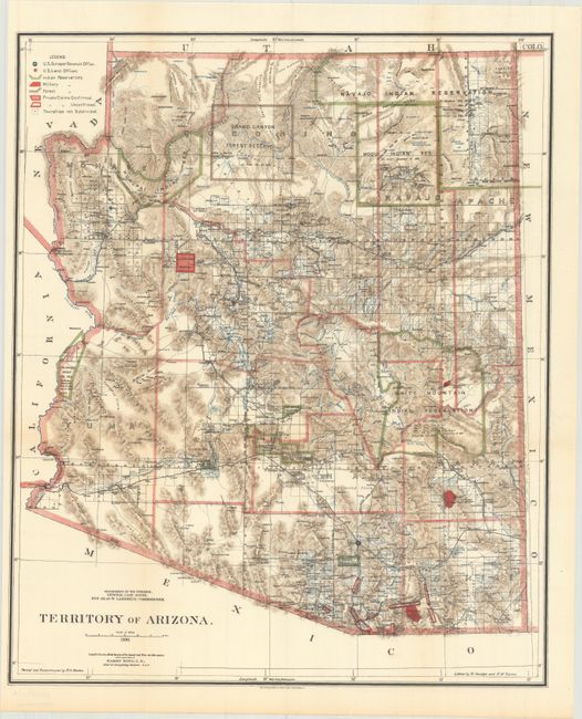
A. Territory of Arizona, dated 1896. This beautifully colored and highly detailed map shows the extent of nine Indian reservations and at least four military reservations including Fort Apache. Indian reservations are outlined in green, military reservations are shown in solid red, and private claims, confirmed and unconfirmed, outlined in red. The Grand Canyon Reserve is shown. The brown hachured mountain areas and the blue waterways combine to provide great visual impact. Information includes watershed, mountains, railroads, wagon roads, private claims, unsurveyed townships, etc. The Hopi reservation is still called the "Moqui" reservation. This edition was revised and reconstructed by R.H. Morton. A very handsome and historical map. Condition: Issued folding. (A+)
B. Territory of Arizona, dated 1907. An updated map from above, five years before statehood. The map clearly shows Indian Reservations, Military Reservations (Fort Apache, Fort Grant, Fort Huachuca, and Fort Whipple), and Forest Reserves via different colors. The new Petrified Forest National Monument (established in 1906) is located east of Holbrook. Condition: Issued folding with a couple tiny splits at fold intersections and an edge tear entering 1" into the neatline at bottom that has been closed on verso with archival tape. (B+)
References:
Condition:
See description above.